Application Description
Discover the city like never before with 2GIS, your ultimate guide to urban exploration. Our app now offers enhanced city routes, real-time traffic updates, transit options, parking information, and offline maps for seamless navigation. We've revamped 2GIS to better showcase the wealth of information we've gathered about cities and businesses. The new design, improved search functionality, and updated city information, along with the integration of favorites from 2gis.ru, make your experience smoother and more intuitive.
2GIS is your go-to source for services, addresses, and company details. Whether you're looking for your utility provider, the nearest district hospital, or a post office, 2GIS has you covered. Choose cafes or service centers based on reviews and photos, and get all the essential details like opening hours and contact numbers at your fingertips.
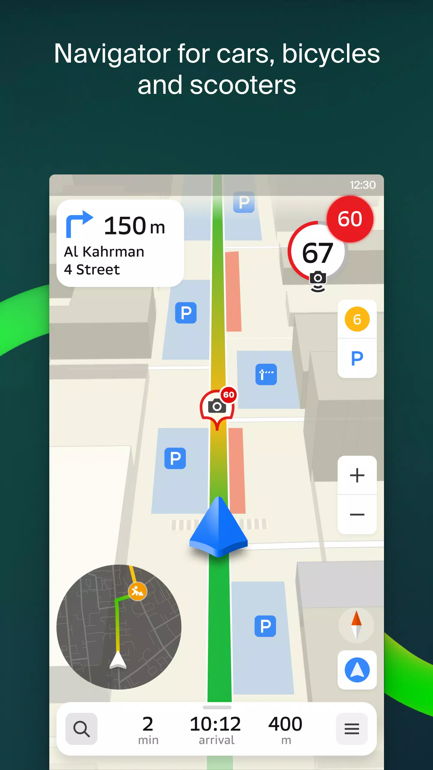
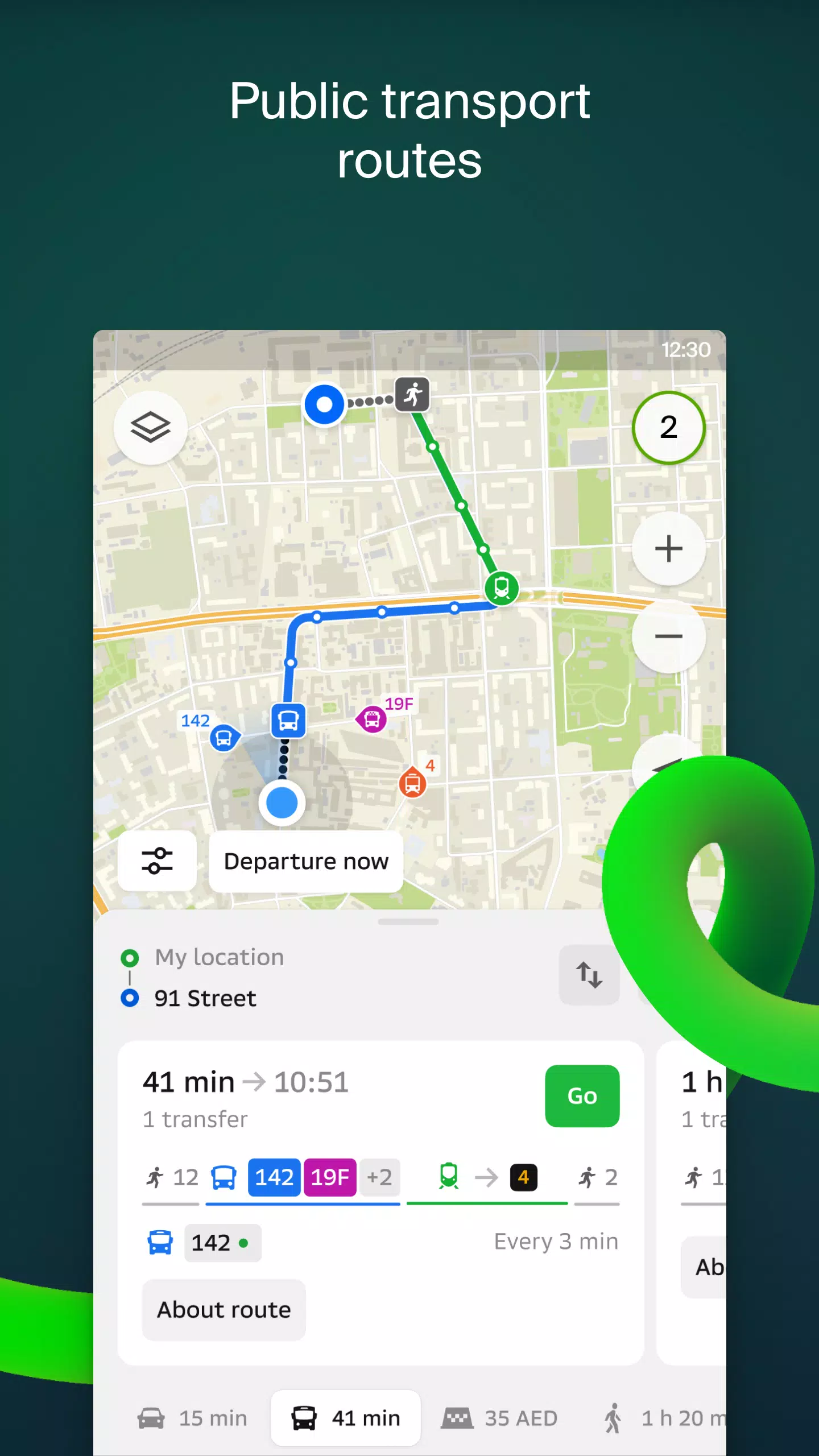
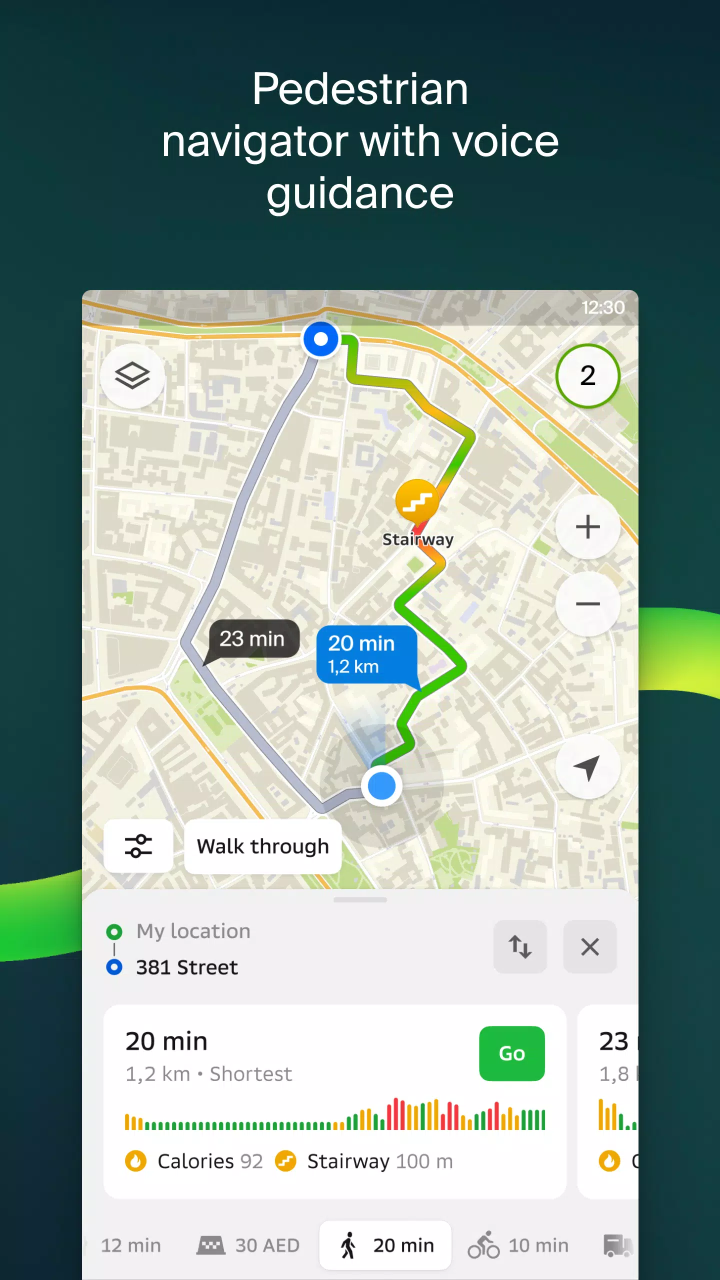
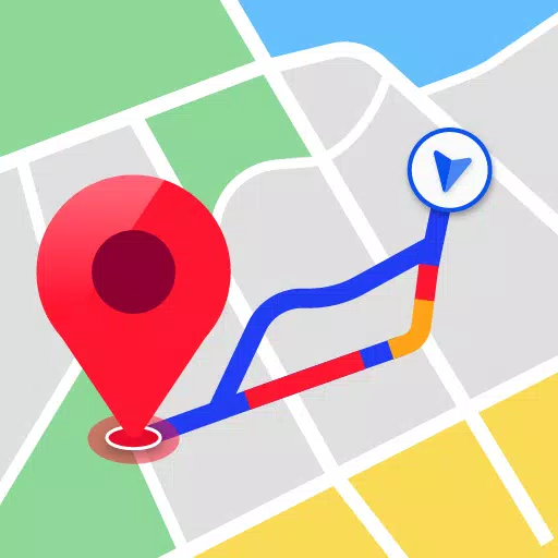
Navigate the city with ease, whether you're driving or walking. For drivers, 2GIS provides voice-guided directions, taking into account traffic jams and road closures, and dynamically updates your route if you stray off course. Pedestrians can find optimal routes using buses, metro, trains, cable cars, and river trams. Our pedestrian navigation works in the background with voice guidance, ensuring you reach your destination effortlessly.
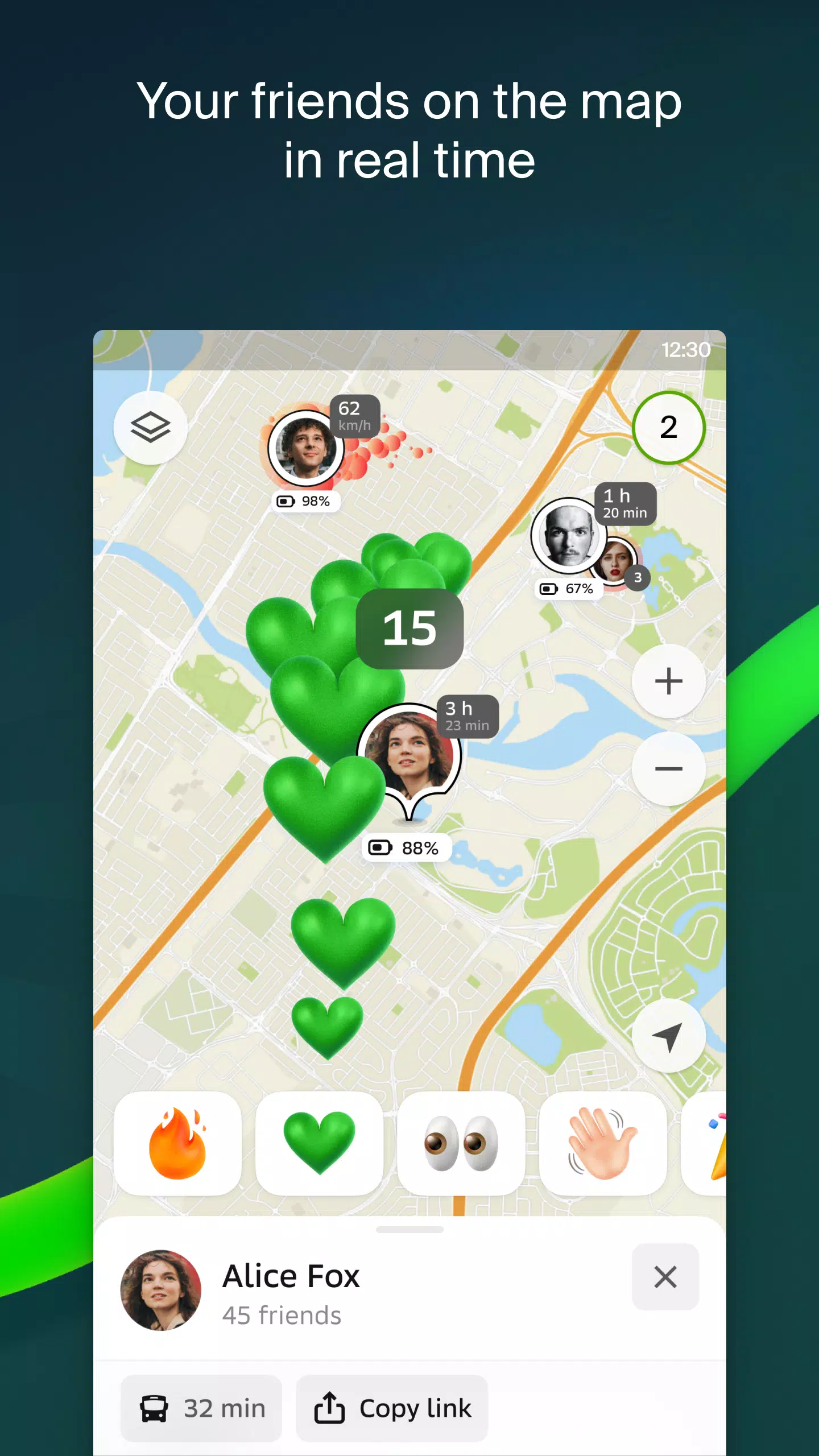
Stay connected with your friends and family through 2GIS. The app now allows you to see the real-time location of your loved ones on the map. You control who can see your location and who you add as friends, with customizable visibility settings.
Finding the entrance to a business center is no longer a hassle. 2GIS knows the entry points for over 2.5 million companies, guiding you right to the door, whether you're using public transport or driving.
Inside large shopping centers, 2GIS helps you navigate with ease. From shops and cafes to ATMs and restrooms, you can plan your visit in advance to save time.
For Wear OS users, the 2GIS beta Notifications companion app enhances your navigation experience. It offers route guidance for walking, biking, or public transport directly from your smartwatch, complete with map views, maneuver hints, and vibration alerts as you approach turns or bus stops. The companion app automatically syncs with your phone's navigation and is compatible with Wear OS 3.0 and later versions.
As a beta tester, you'll receive the latest updates as we fix bugs and improve the app, contributing to the development of a new version that will soon be used by millions. You can run both the original and beta versions simultaneously, switching between them as needed.
For any support, reach out to us at [email protected].
What's New in the Latest Version 6.44.1.559.3
Last updated on Oct 19, 2024
Experience beautiful, crisp updates tailored just for you:
- We now display wide, realistic roads on the main map and when searching for routes.
- Introducing much-anticipated Chats for Friends! Message each other without leaving the map.
- Added notifications when a friend is nearby (can be turned off in settings).
- Just in time for ski season: we've added ski lift statuses on slopes: see whether they're open or not.
- If your public transport route includes walking, we’ll calculate the walking part in steps.
Screenshot
Reviews
Post Comments
Latest Articles

Australia Bans Silent Hill f Over Content
Silent Hill f Faces Australian Ban Due to Controversial ContentKonami's upcoming horror title Silent Hill f has been officially denied release in Australia following its "Refused Classification" verdict from the national ratings board. Discover what

Summoners War Celebrates 11 Years with Anniversary Events
Summoners War: Sky Arena marks its 11th anniversary. Having thrived for over 4,000 days and amassed more than 240 million downloads, the game is set for an epic celebration. Com2uS is pulling out all the stops to deliver.What Can Players Expect?The 1

Azur Lane Launches High Tower Rose Event
The "A Rose on the High Tower" event is now live and will run until June 11th.Six new shipgirls have joined the roster.A collection of new skins is also available in the shop.Azur Lane's latest event, "A Rose on the High Tower," has launched, deliver
Fortnite Ch6 S2 Gold Rush: How to Trigger It
Fortnite Chapter 6, Season 2: Lawless revolves entirely around cold, hard cash. Crime boss Fletcher Kane has established safehouses across the island, and seizing control of one yields special perks. Here's everything you need to know about the new G

"Deadlock Unveils New Heroes, Skills, Weapons, Story"
Deadlock has been available for several months, expanding its roster with six new work-in-progress heroes. Continue reading to discover details on Deadlock’s latest characters, along with an overview of every hero’s skills, weapons, and lore.Deadloc
Where To Preorder Pokémon TCG: Black Bolt and White Flare
Pokémon TCG’s new Scarlet & Violet expansions, Black Bolt and White Flare, are set to launch at major retailers including Best Buy and Amazon starting May 8 in the US. Here’s where to secure your preorder.### White Flare ETB$49.99 at Best Buy### Vict
Apps like 2GIS beta


Kimber Cabs
Maps & Navigation丨21.7 MB


Apporio Super App
Maps & Navigation丨35.5 MB
Latest Apps


RHG ENERTÜRK
Auto & Vehicles丨42.3 MB
UNO STAR
Auto & Vehicles丨11.4 MB

Bus marshrutochka.bel
Auto & Vehicles丨76.1 MB

Yaskrava
Auto & Vehicles丨13.0 MB

Auctionwini
Auto & Vehicles丨54.7 MB
Ctparkea
Auto & Vehicles丨25.9 MB

ZEVpoint
Auto & Vehicles丨63.3 MB

Regeny
Auto & Vehicles丨35.1 MB
Trending Apps
MORE +


Top News
MORE +


01
01-01
Call of Duty: Black Ops 6 Adds Fan-Favorite Modes
Call of Duty: Black Ops 6 receives classic game modes and map updates this week, addressing post-launch issues. The highly anticipated "Infected" mode arrives tomorrow, followed by the iconic "Nuketown" map on Friday, November 1st.
Infected and Nuketown Enhance Black Ops 6
Treyarch, the developer,
02
03-13
Top 10 LitRPG Books for 2025
Reading is my absolute favorite pastime. While I enjoy video games and TV, nothing quite compares to immersing myself in a captivating book series. My reading journey began with Harry Potter, branching out to sci-fi, fantasy, mysteries, and even some non-fiction. But my true literary passion ignite
03
04-08
Kingshot Beginner's Guide: Mastering Tower Defense Mechanics
Dive into the thrilling world of Kingshot, a multiplayer strategy game that masterfully combines precision shooting with tactical warfare. Set against the backdrop of a medieval fantasy realm, you step into the shoes of a powerful monarch, locked in a fierce struggle for supremacy over rival kingdom
04
03-05
Helldivers 2: Superstore Rotation (All Armor & Items)
Helldivers 2 Superstore: A Complete Guide to Armor and Item Rotations
Equipping the right armor is crucial in Helldivers 2. With diverse armor types (light, medium, heavy), unique passives, and varying stats, choosing your gear is a strategic decision. The Superstore offers exclusive armor sets an
05
04-26
Delta Force: Comprehensive Guide to All Combat Maps
Delta Force, the much-anticipated mobile shooter, is set to hit the mobile gaming scene this April. As the release date approaches, it's the perfect moment to familiarize new players with the diverse combat maps that await them. The game features four core maps: Zero Dam, Layali Grove, Brakkesh, and
Topics
More +